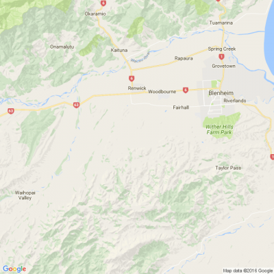
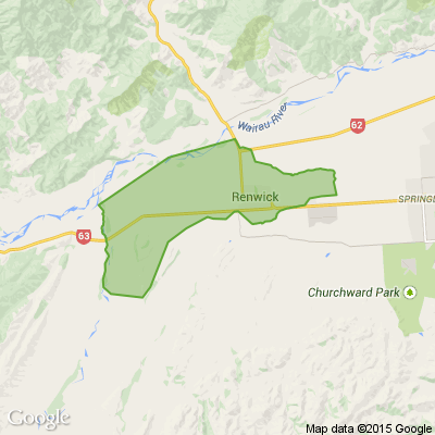
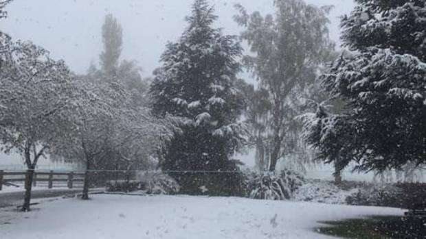
Severe weather warning for Marlborough - heavy snow and gales
A trough of low pressure moves east across central and northern New Zealand today, spreading a strong cold southerly flow across the country. Snow is expected to low levels over many parts of central and southern New Zealand, and severe gale southerlies for parts of central New Zealand.
Heavy snow may disrupt travel in affected areas and could damage trees and powerlines. Cold conditions may cause stress for livestock.
Valid: 13 hours from 11:00am Friday to 12:00am Saturday
Forecast: Snow is expected to lower to about 300 metres this (Friday) morning. During today, 15 to 30cm of snow may accumulate above about 500 metres with lesser amounts down to 300 metres. The snow is likely to be heaviest around midday and early this afternoon, then the snow should gradually ease.
Forecast: Severe gale southerlies gusting 120 km/h in exposed places.
Today’s Mind-Bender is the Last of the Year! Can You Guess It Before Everyone Else? 🌟🎁🌲
I dance in the sky with green and gold, a spectacle few are lucky to behold; I’m best seen in the south, a celestial sight—what am I, lighting up the New Zealand night?
Do you think you know the answer? Simply 'Like' this post and we'll post the answer in the comments below at 2pm on the day!
Want to stop seeing these in your newsfeed? No worries! Simply head here and click once on the Following button.

No gift? No stress
Let the Christmas elves at Mags4gifts.co.nz handle your last-minute shopping. For a limited time, gift a subscription with up to 40% off best-sellers like TV Guide, NZ House & Garden, and NZ Gardener. It’s the perfect Christmas present, sorted in minutes (and no one needs to know it was a last-minute surprise)!

Poll: Is it ok to regift something that you have been given?
🎁 Holiday Gift Chat!
Do you ever regift?
What’s your take on asking for a receipt if a gift doesn’t fit?

-
79.3% Yes! It's better to regift what I don't need
-
20.7% No. It's the thought and effort that matters
 Loading…