Cyclone impacted catchments tracked
From local democracy reporter Brendon McMahon:
Landslides high above State Highway 67 north of Westport in a stream catchment straddling an active fault-line is worrying the West Coast Regional Council.
An internal engineering staff report has highlighted the deterioration of vegetation on slopes at Barrytown and parts of Buller from Cyclone Ita in 2014, and delves into the progressive erosion in the Lake Stream catchment, 10km northeast of Westport township.
The cyclone caused massive damage throughout the entire West Coast, flattening swathes of native forest and vegetation, particularly in river valleys.
In Buller, the Lake Stream catchment on Mt Rochfort had already split into three channels by the time of the heavy storm this February, but the erosion has now escalated, regional council engineer Paulette Birchfield said.
"Multiple landslides" had left a huge volume of slip material sitting high up in the catchment, about 1 kilometres above the highway.
When the slip material did eventually move it could radically change the stream's direction, with significant potential to spill on to the road at the bottom of the slope, Birchfield said in her report.
The majority of the slips in Lake Stream were in the upper catchment, diverting the flow across a fan. In future heavy rain events the high slip material was likely to mean the stream would "take any number of other flow paths".
Birchfield said the possibility of mechanically diverting the flow and excavating the original Lake Stream channel would be difficult. Steep topography and thick vegetation made both foot and access for machinery challenging.
A large-scale landslide did occur in the catchment in at least 2015, a year after Cyclone Ita, and this had been supplying increased sediment and debris to the Lake Stream channel.
In normal conditions the stream flow would not have sufficient energy to transport additional slip material and the channel would slowly evolve in response.
However, an earlier heavy rainfall event in early May 2020 was probably large enough to move significant volumes of sediment and debris, causing Lake Stream to tear away from its original channel, breaking out in several places.
A 1997 thesis noted that until the downstream channel width and depth was increased to the new flow regime, floodwaters would continue to break out of the channels and drains, causing flooding and sedimentation of farmland and damage to property.
PICTURES: West Coast Regional Council
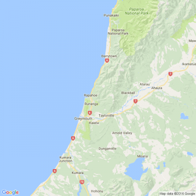
1: Lake Stream catchment, north-east of Westport.
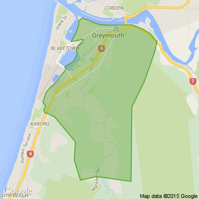
2: Approximate location of the diversion site in Lake Stream.


Poll: Do you set New Year’s resolutions?
🎉 2026 is almost here!
We’re curious ... how do you welcome it?
Do you set resolutions, follow special traditions, or just go with the flow?

-
10.4% Yes! New Year, New Me
-
20.1% Yes - but I rarely stick to them
-
69.5% Nah - not for me
🎉The Riddler wants to hear from you 🫵
🧩 Got a riddle that can stump your Neighbourly community? Share your brain teasers with us and watch your neighbours scratch their heads 😕🤔❓
Send us your tricky puzzles!

Scam Alert: Fake information regarding December Bonuses from MSD
The Ministry of Social Development is reporting that fake information is circulating about new ‘December bonuses’ or ‘benefit increases’
If you get suspicious communication, please contact Netsafe.

 Loading…